News . Best Practices Creating & using maps for problem-solving: open schooling with open scenario in Greece (Best Practice Greece)

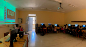
The implementation of this scenario took place in a state school named High School of Tefeliou Monofatsiou, at the island of Crete, Greece. From the total 17 students of this class, 12 students participated at the CONNECT project but all of them implemented the scenario.
CARE-KNOW-DO: The scenario follows the structure of Connect: CARE-KNOW-DO and the methodology of participatory science. Students & teachers are participating in all stages, scientists & parents at the stages of “Care” and “Do”, local authorities at “Do” level. The role of the scientist (University of the Aegean, Geography department) was quite critical as at the first level of “Care” he gave initiatives to students in order to start over the process of creating their digital map and at the third level of “Do” where he assisted students on how to present their results, how to make proposals, to discuss in total student’s investigations and to reply to any student’s question about this map creation. The role of teacher is to support students in all stages and motivate them for their personal growth, for further investigating, to encourage them for spatial thinking etc. The role of parents is to communicate, participate, assist, and help students with their questions/actions as they have an active role during this process.
Outcomes: The outcome of this scenario was a variety of student’s spatial questions which are forwarded to local community for further actions and investigation. For example: environmental pollution, accessibility & proximity issues, promoting local places that are not known yet, bad roads/buildings condition, lack of spatial interactions, lack of basic infrastructure etc. The initial limitation of this scenario was the reluctancy of participation as students/their parents haven’t faced something similar before; after the completion of this scenario all students requested to have similar projects for action to other study fields.
Findings: Another benefit of this scenario was that it took place during pandemic as all students were online and they could participate with scientist meetings. Scientist intrigued student’s mind and of course broaden the knowledge for cartography and the use of maps in daily life. The fulfilment of both cartography labs led students to working in teams, to resolving problems, to spatial thinking, to be more tech-savvy and generally to encourage students for improvement. Overall, there was a great cooperation among everyone, and the scenario implementation was in benefit of all the participants.